Natural site· Refahiye, Erzincan
Köroğlu Mağara Yerleşmesi
If you have a photo of this place, upload it; it appears here after review.
Editor's Note
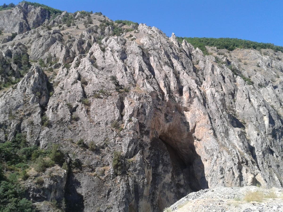
The Köroğlu Stream flows past the entrance of this cave, located 10 km northwest of the Refahiye district. Lying west of the Erzincan-Sivas highway, on the northern slope of Mount Dumanlı, the cave was later inhabited. A rounded arch marks the entrance of this man-made cave, with earth used as the mortar in its construction. The dwelling was created by enlarging the cave in the bedrock. As one climbs up the steep face of the bedrock, the settlement divides into two parts, east and west. [1] The cave is reached by stone steps, and inside there are seating benches made of cut stone.
Practical info
- Location
- 39.9439°N · 38.7277°E
Reviews
Be the first to leave a word.
A rating and a few sentences. It helps the next visitor.
Nearby
Köroğlu Mağarası
Natural site · Refahiye, Erzincan
Bahattin Paşa Anıtı, Refahiye
Monument · Refahiye, Erzincan
Esat Muhlis Camii Çeşmesi
Monument · Refahiye, Erzincan
Toprakkale Höyük, Çavuş
Ancient site · Refahiye, Erzincan
Küçük Höyük, Çavuş
Ancient site · Refahiye, Erzincan
Demirkonak Höyük
Ancient site · Gölova, Sivas